Change your map view in Maps on Mac
You can switch map views and personalise other settings, such as appearance, travel mode and more.
Note: Not all traffic, public transport and detailed city maps are available in all countries or regions. Flyover Tours aren’t available in all countries or regions. See the macOS Feature Availability website.

Switch to a different map view
Go to the Maps app
 on your Mac.
Click
 near the top right of the map.
Note: If you previously switched to the Driving, Transit or Satellite map,
 ,
,  , or
, or  appears instead of
  .
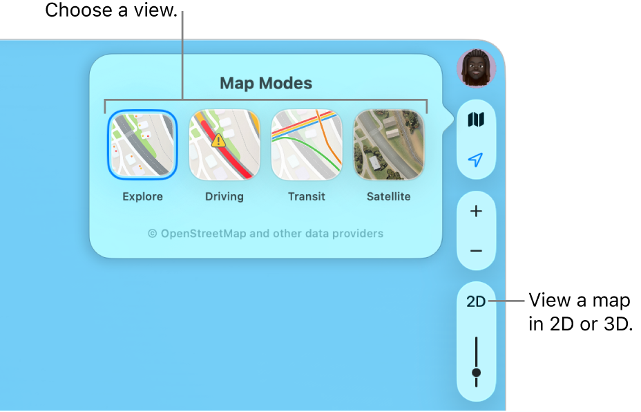
.Choose one of the following:
Explore: Shows the standard map. If you have a Mac with Apple silicon, you can see additional details of elevation, roads, trees, buildings, landmarks and more in selected cities.
Driving: Shows traffic conditions and puts the focus on roads. See Show traffic conditions.
Public transport: Shows bus stops, airports, public transport lines and stations.
Satellite: Shows satellite images. Select Traffic or Labels if you want a hybrid view between the explore and satellite views.
See maps in 3D
Go to the Maps app
 on your Mac.
Do any of the following:
Tilt the map: Choose View > Show 3D Map. Zoom in to see buildings, trees and other details. On the right, click the 3D button, then drag the slider to adjust the angle.
If you don’t see the 3D button, press Command-D.
View the earth with an interactive globe: If you have a Mac with Apple silicon, zoom out until the map changes to a globe. Drag the globe to rotate it, or zoom in or out to explore details for mountain ranges, deserts, oceans and more.
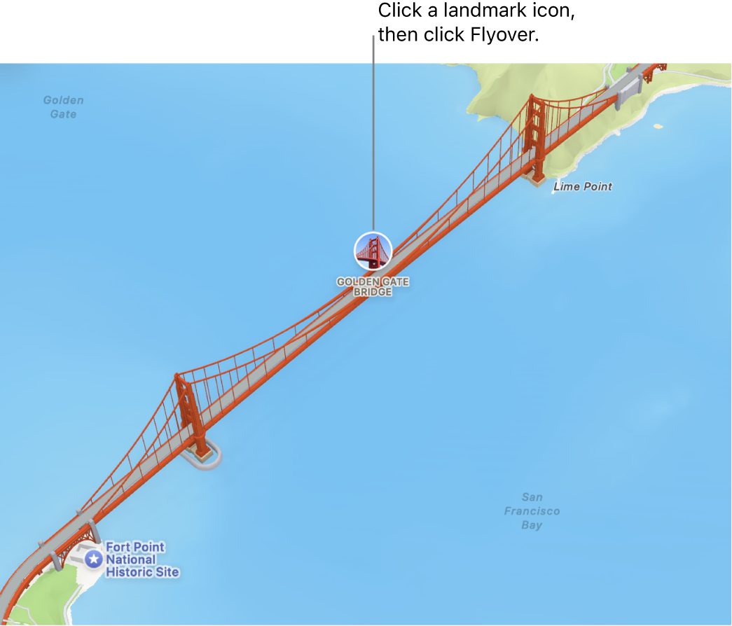
Fly virtually over a landmark or city: Many of the world’s major landmarks and cities are identified by unique icons. Click the name or icon, then click Flyover.

Use dark colours
Go to the Maps app
 on your Mac.
Choose Maps > Settings, then click General.
Deselect “Always use light map appearance”.
This setting affects maps in other apps such as Contacts, Calendar and Photos. To use dark colours for the entire screen, see Use a light or dark appearance.
Show a distance scale
Go to the Maps app
 on your Mac.
Choose View > Show Scale.
View labels on the map
Go to the Maps app
 on your Mac.
Do any of the following:
Make map labels larger: To enlarge the labels in any view, choose Maps > Settings, click General, then select Use Large Labels.
Show labels in satellite view: Choose View > Satellite or press Command-4, then choose View > Show Labels.
Set your preferred language for map labels: To always use your computer’s preferred language for map labels, regardless of the language of the country or region you’re viewing, choose Maps > Settings, click General, then select Always Show Labels in [language]. To choose a different language, see Change the language your Mac uses.
Zoom, move or rotate a map
Go to the Maps app
 on your Mac.
Do any of the following:
Zoom in and out: Click
 and
and  on the right side of the map.
To show the map’s scale as you zoom, choose View > Show Scale. The scale appears along the top.
Move up or down, left or right: Click and hold the mouse or trackpad, then drag the map. On a trackpad, you can also swipe using two fingers.
Rotate a map: Click and hold the compass while you drag left and right, or up and down.
After you rotate a map, you can return to the north-facing orientation by clicking the compass, or pressing Shift-Command-Up Arrow.
You can also use shortcuts or gestures to zoom.